
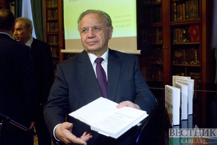
After Azerbaijan gained independence, Hasan Hasanov became the first head of the government of the independent republic. Later he held the post of Permanent Representative of the Republic of Azerbaijan to the UN, headed the Foreign Ministry of Azerbaijan, and now holds the post of Ambassador Extraordinary and Plenipotentiary to Poland and is studying the history of his country. A year and a half ago, a presentation of Hasan Hasanov's book "Alexander the Great and Atropat", dedicated to the ancient history of Azerbaijan, was held at the All-Russian State Library of Foreign Literature named after MI Rudomino. Today, in the context of what is happening around Nagorno-Karabakh, understanding the ancient history of Azerbaijan acquires special relevance.
- Can you give a historical information about the Karabakh region of Azerbaijan? What was the geopolitical situation of this region in antiquity?
- "Karabakh" - the name is later, therefore, given that in ancient times the region was not called that, we will use the name "Eastern part of the South Caucasus" and "Kura-Araks interfluve". The earliest reports of peoples living in the Eastern part of the South Caucasus and the Kura-Araks interfluve are found in the Assyrian cuneiform texts. At the beginning of the VIII century. BC, according to Assyrian sources, a country called "Gamir" was located here. This country was named after its population, which were Turkic-speaking Cimmerians, bearers of an archaeological culture known in Soviet science as the "Srubnaya culture". By the way, the same sources report that in 714 BC. the kingdom of Urartu tried to invade this region, but they were defeated by the army of Gamir, and as a result the Urartian king Rusa I committed suicide. According to Herodotus, later the Sako-Scythians began to arrive in this region. In 673 BC. the Scythians seized power in this country, and it, according to the same Assyrian cuneiform texts, began to be called "Ashguz".
- To what extent was this ethnic picture reflected in later, in particular in Greco-Roman sources?
- Ancient Persian Bisutun rock texts (VI century BC) report that Saki-tigrahauda live in the Kura-Araks interfluve, which translates from Persian as "Saki with pointed hats." Herodotus in the 5th century BC. reports that "Scythians-Orthokoribantians" lived here, which is also translated from Greek as "Scythians with pointed caps." Arrian (II century) speaking about the events of the IV century. BC, when Alexander the Great invaded the South Caucasus, notes that "Sakesins and Albanians lived here." Contemporary American researcher Adrienne Mayor believes that Nushaba is "a Saka queen from Caucasian Albania" and adds: "Scientists believe that Nushaba was created by Nizami on the model of the Saka-Scythian woman leader from Sakasena, near Barda, in central Azerbaijan." In the second century BC. Pliny also places Sakasans in the region of the Kura-Araks interfluve. Strabo (1st century BC - 1st century AD) reports that "Sakasena borders on Albania". As you can see, for eight centuries, in the region of the Kura-Araks interfluve, according to Assyrian, ancient Persian and Greco-Roman sources, lived Cimmerians and Ashguzes (Assyrian texts), as well as other Scythian-Saka peoples: Saks with pointed hats (Bisutun), Scythians with pointed hats (Herodotus), Sakesins (Arrian), Sakasans (Pliny), Sakasens (Strabo), which researchers belong to the Turkic-speaking ethnic groups.
- How and when did the connection between the Kura-Aras interfluve and a country called "Atropatena" arise?
At the beginning of the VII century. BC. from the north, through modern Derbent, the Scythians began to arrive in the region, as reported by Herodotus. But here they find Sakas, who had previously arrived along the southern coast of the Caspian Sea. Herodotus says that the Scythians and Sakas are one and the same people. They unite here and represent a powerful military potential. In 623, the Scythian-Saks became, as Herodotus says, the hegemons of the region for 28 years, that is, until 594 BC. The Roman author Ammianus Marcellinus says that as a result of the destruction of the Assyrian Empire, a new country was formed called Atropatena. The Syrian chronicle Karkhi de Bet Selokh also reports that as a result of the fall of the Assyrian empire, a new country called Adorbaigan was created. The New Babylonian cuneiform text says that the Assyrian Empire was destroyed in 612 BC, that is, during the period of Scythian hegemony. This text says that the empire was destroyed by the Umman-Manda people, by which the Scythians were meant. The ancient authors Diodorus and Curtius Rufus also unequivocally report that the Assyrian Empire was destroyed by the Scythians. That is, it can be argued that the country of Atropatena / Adorbaigan was created in 612 BC. it was the Scythians who ruled in the eastern part of the South Caucasus, in the kingdom of Ashguz, and the Kura-Araks interfluve was originally part of the country of Atropatena / Adorbaigan. Therefore, the assertion that the name "Azerbaijan" refers only to the territories south of the Araks River is far-fetched and does not have any source study basis.
- What peoples participated in the creation of the country called Atropatena / Adorbaigan and inhabited it?
- According to reports of the New Babylonian and ancient Greek sources, the war to destroy the Assyrian Empire was led by two peoples - the Scythian-Saks and the Babylonians, with some participation of the Medes. After the destruction of the Assyrian Empire, the conquered lands were divided between the Scythians and the Babylonians. The Babylonians created their kingdom and annexed part of the Assyrian lands. The Scythians, along with their own kingdom of Ashguz (the entire eastern part of the South Caucasus, including the Kura-Aras interfluve), additionally accounted for the lands of the Assyrian allies Manna and Urartu, as well as most of the Assyrian lands proper. The country of Atropatena / Adorbaigan, as the sources testify, was created by the Scythian-Saki, called quz in Assyrian and Greco-Roman sources, which researchers identified with the ancient Oghuz. At the same time, at the time of its creation, Atropatena / Adorbaigan was inhabited and participated in the creation of this state by its indigenous people, Caucasian-speaking, Iranian-speaking and Semitic-speaking peoples, who are equal citizens of Azerbaijan.
- What territory did Atropatena / Adorbaigan occupy at the time of its formation?
- Herodotus (5th century BC) reports that the western borders of the Scythian country extended to the Galis River in Anatolia (the modern Kyzyl-Irmak river). Polybius (200 BC), referring to Atropatene and her ruler, reports this in more detail: "Artabazan ... was revered as the most powerful and wisest of the rulers and ruled over the so-called" atropathies "and the peoples bordering on them ... Artabazan, which lies near the Media, separated from it only by intermediate mountains; some parts of it, which are higher than Phasis (modern river Rioni, in Georgia), dominate the Pontus (modern Black Sea), and the region reaches the Hyrcanian Sea (modern Caspian Sea) Here lives a warlike people, mainly delivering cavalry and generally having abundance in everything that is required for a war. This kingdom has survived from the time of the Persians, for under Alexander it was overlooked. " As can be seen from the messages of Herodotus and Polybius, Atropatena occupied the entire space from the South Caucasus to Media, from the Caspian Sea to the Galis River in Anatolia. It becomes clear that the Kura-Araks interfluve, where the present Karabakh region is located, starting from the 7th century. BC, when the country called "Atropatena / Adorbaigan" was created, was part of it.
- How did the further fate of the Kura-Araks interfluve develop, that is, the modern Karabakh region?
- In the III century. a new Persian-Sassanian empire was formed, which conquered Atropatena and Albania and united them in its composition, into a single region called "Adurbadkan". Thus, from the VII century. BC. and up to the 1st century. BC, the Kura-Arax interfluve was part of the kingdom of Atropatene. From the 1st century. BC. and up to the VII century. AD The Kura-Araks interfluve was part of the Albanian kingdom, while from the 3rd century. together with Azerbaijan it was under the control of the Sassanian Empire as a single region - Adurbadkan. During this period of history, one of the regions of Albania is called "Bagasakan region", that is, the region where two peoples lived - Saks and Bagi.
- We approached the 7th century, when the Arabs invaded Azerbaijan and Albania. What is happening with the Kura-Aras interfluve?
- By the arrival of the first Arabs (VII century AD), the name "Albania" fell out of use. In all likelihood, this was caused by his 300-year stay in the Sassanid region of Adurbadkan. From that time on, the Kura-Araks interfluve began to be called "Aran". The Arab geographer Al-Hamawi (XII-XIII centuries) reports that Aran is a non-Arabic name. The phrase by H. Qazvini (historian of the XIII century of the Hulaguid dynasty, originally from the city of Qazvin) that Arran "is a land between two rivers" is actually the etymology of this toponym. Aran comes from the Türkic word "ara / between, interval" and covers the entire territory of the Kura-Araks interfluve in the South Caucasus region. During the Arab Caliphate, Aran and Azerbaijan (this phonetic form appeared with the arrival of the Arabs) were united into a single region under the control of the Arab governor, and the Arab authors call the entire South Caucasus region, including the Kura-Araks interfluve, "Azerbaijan". Under the leadership of the Turkic dynasty of the Sajids (at the beginning of the 10th century), Azerbaijan, including the South Caucasus region and the regions around Lake Urmia, seceded from the Arab Caliphate and proclaimed an independent Azerbaijani state. Later, during the reign of the Salarids and Ravvadids dynasties, Azerbaijan retained its territorial integrity. Since the XI century. the period begins during which Azerbaijan becomes the invariable metropolis of the great Turkic empires. During the reign of the Turkic dynasty of the Seljukids and Ildenizids, the Kura-Araks interfluve was controlled by these dynasties, and the cities between the rivers Barda, Ganja and Nakhchivan are provincial centers or capitals.
- You mentioned the sources according to which from the 7th century, after the Arabs, the Kura-Araks interfluve began to be called "Aran". And when did the region become known as "Karabakh"?
- Historian of the XIII century. F. Rashidaddin reports that by the time the first Chingizids arrived, the Kura-Araks interfluve was still called "Aran". For the first time, the name "Karabagh Aran" was mentioned a little later, during the reign of Azerbaijan by the Hulaguid and Chingizid dynasty, which began in 1256. At the same time, he emphasizes that "Garabagh is part of the administrative division of Azerbaijan." It is important to note that F. Rashidaddin uses three toponyms in relation to the South Caucasus region at the same time: Shirvan, Aran and Karabag. Perhaps Shirvan covers the region north of the Kura River, Aran covers the entire Kura-Arak interfluve, and Karabagh - that part of the interfluve, which is now called Karabagh. F. Rashidaddin notes that the ruler of the empire, the son of Hulagu-khan, Abaga-khan, "established the capital of Tabriz as the place of the royal residence, and chose Aran as the winter camp." This is confirmed by another report by F. Rashidaddin that Gazan Khan Khulaguid, having converted to Islam, inaugurated and ascended the khan's throne as the Muslim ruler of Azerbaijan on November 3, 1295 in Karabagh Aran. The priority character of the Karabakh region was preserved during the subsequent dynasties that ruled Azerbaijan. Al-Ahari (XIV century), describing the period of reign of Jelairid Sheikh Uweis [XIV century], writes: "Karabag, which was the capital of Aran." Hamdallah Kazvini [XIV century] writes that "the border of Karabakh extended to the Araz River". Author of the XIX century. G.Z. Shirvani emphasizes that "Garabagh is a region of Azerbaijan. It has a lot of wealth, the population is Turks." During the Safavid period, Azerbaijan was divided into four beylerbeks: Shirvan, Garabagh, Chukhursaad [or Erivan] and Azerbaijan [or Tabriz]. After the collapse of the empire, led by Nadir Shah, the Karabakh beylerbekstvo became an independent Karabakh khanate, created by Panakh-khan Jevanshir.
- How did the name "Karabagh" come about?
- From my point of view, the version when "Karabagh" is etymologized as "Black Garden" can be attributed only to the period of the occupation of this territory by Armenia. In fact, the word "gara" has several meanings, including "people". As for the word "bag" ("bag" in the meaning of "garden" is not a Turkic, but a Sogdian word) - this is an ethnonym, that is, the name of a people who, according to M. Kagankaytuklu, lived in the region of Albania called the "area of bugs". Our historian Sarah Ashurbeyli claims the same. Thus, "Karabag" means "the Bagh people" or "the country of the Bagh people" or "the land of the Bagh people" The reader may have a question in connection with the fact that throughout the interview we said that the listed ancient Azerbaijani kingdoms created the Scythian-Saks: "Who were the Bugs in that case?" Sources provide an answer to this question as well. Sara Ashurbeyli says that Albania had a region and a city of Bagasakan, while she identifies this region with the Mil steppe, and the city with the city of Baylakan. Bagasakan is also mentioned in reports about the first Arab conquests in Albania. There is reason to recognize that Bagi is one of the Scythian-Saka peoples.


